
What Are FIR NOTAMs?
While most pilots are familiar with airport-specific NOTAMs (runway closures, lighting outages, etc.), FIR NOTAMs cover an entirely different category of critical information. FIR NOTAMs apply to entire Flight Information Regions—massive chunks of airspace that can span hundreds or thousands of square miles.
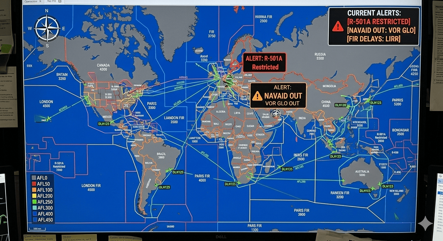
Understanding FIR NOTAMs is essential for any pilot flying beyond their local area, as these notices can affect your entire route, not just your departure or destination airports. From military exercises to GPS outages, navigation aid failures to airspace restrictions, FIR NOTAMs provide the big-picture information you need for safe en-route operations.
🌍 Scale Matters: A single FIR can be larger than many countries. For example, the Gander Oceanic FIR covers over 2 million square miles of the North Atlantic, while the Anchorage FIR covers most of Alaska and extends far into the Pacific.
Understanding Flight Information Regions (FIRs)
What is a FIR?
A Flight Information Region (FIR) is a specified region of airspace in which a flight information service and alerting service are provided. The world's airspace is divided into these FIRs, with each managed by a specific air navigation service provider.
Key characteristics of FIRs:
- Cover both controlled and uncontrolled airspace
- Extend from the surface to a specified upper limit (usually FL660 or unlimited)
- Do not follow political boundaries (one country may have multiple FIRs)
- Managed by an Air Traffic Control center or Flight Information Centre
- Each has a unique four-letter ICAO code
FIR vs UIR
Many regions also have Upper Information Regions (UIRs) that cover the upper airspace:
- FIR: Typically surface to FL245 or FL285
- UIR: Typically FL245/FL285 to FL660 or unlimited
NOTAMs can apply to FIRs, UIRs, or both depending on the altitude of the affected area.
Major FIRs Worldwide
North America
United States:
- KZNY: New York Center (covers Northeast US and portions of Atlantic)
- KZDC: Washington Center (Mid-Atlantic states)
- KZMA: Miami Center (Florida and Caribbean approaches)
- KZAU: Chicago Center (Upper Midwest)
- KZLA: Los Angeles Center (Southern California and Southwest)
- KZSE: Seattle Center (Pacific Northwest)
- KZAK: Anchorage Center (Alaska and North Pacific)
Canada:
- CZEG: Edmonton FIR (Western Canada)
- CZWG: Winnipeg FIR (Central Canada)
- CZUL: Montreal FIR (Quebec and Eastern Canada)
- CZQX: Gander Oceanic FIR (North Atlantic)
Europe
Major European FIRs:
- EGTT: London FIR (United Kingdom airspace)
- EGPX: Scottish FIR (Northern UK and North Atlantic approaches)
- LFFF: Paris FIR (Northern France)
- EDGG: Langen FIR (Central Germany)
- EDWW: Bremen FIR (Northern Germany and North Sea)
- EHAA: Amsterdam FIR (Netherlands)
- LECM: Madrid FIR (Central Spain)
- LIBB: Brindisi FIR (Southern Italy and Mediterranean)
Asia-Pacific
- RJJJ: Fukuoka FIR (Western Japan and approaches)
- RKRR: Incheon FIR (South Korea)
- VHHK: Hong Kong FIR (Hong Kong and surrounding waters)
- VDPP: Phnom Penh FIR (Cambodia)
- VTBB: Bangkok FIR (Thailand)
- YSSY: Sydney FIR (Eastern Australia)
Middle East & Africa
- GMMM: Casablanca FIR (Morocco and approaches)
- DAAA: Algiers FIR (Algeria)
- HECC: Cairo FIR (Egypt and Eastern Mediterranean)
- OJAC: Amman FIR (Jordan and region)
- OMAE: Emirates FIR (UAE and Gulf waters)
- HKNA: Nairobi FIR (Kenya and East Africa)
Types of FIR NOTAMs
1. Navigation Aid NOTAMs
These affect VORs, NDBs, DMEs, and other navigation facilities that serve en-route traffic:
Example:
Q) KZNY/QNVVV/IV/NBO/E/000/999/4045N07356W025
A) KZNY
B) 2602271400
C) 2602281400
E) VOR ABC 117.5 U/S
Translation: The ABC VOR (117.5 MHz) in the New York Center FIR is unserviceable from February 27, 1400 UTC to February 28, 1400 UTC.
Impact: Aircraft depending on this VOR for navigation must use alternative means (GPS, other VORs) or file different routes.
2. Airspace Restrictions
Temporary or permanent changes to airspace structure, including restricted areas, danger areas, and prohibited areas:
Example:
Q) KZDC/QRTCA/IV/BO/W/000/180/3845N07645W015
A) KZDC
B) 2602280800
C) 2602281600
D) 0800-1600
E) RESTRICTED AREA R-4001 ACT SFC TO FL180
F) SFC
G) FL180
Translation: Restricted Area R-4001 is active on February 28, from 0800-1600 UTC, surface to FL180.
Impact: Aircraft must avoid this area or obtain specific clearance to transit it.
3. Military Exercises
Large-scale military operations that affect civilian airspace:
Example:
Q) EGTT/QWMXX/IV/M/AE/000/200/5230N00130W050
A) EGTT
B) 2603010600
C) 2603051800
E) MILITARY EXERCISE ACT WI 50NM RADIUS OF 5230N00130W
SFC TO FL200. INTENSE AIR ACT CAN BE EXPECTED.
CONTACT LONDON CONTROL 124.75 FOR TRANSIT CLEARANCE
F) SFC
G) FL200
Translation: Military exercise active March 1-5 within 50 nautical miles of coordinates 52°30'N 001°30'W, surface to FL200. Intense air activity expected; contact London Control on 124.75 for transit clearance.
Impact: Civilian aircraft should expect delays, rerouting, or denial of transit through the exercise area.
4. GPS/GNSS Outages
Temporary GPS interference or testing that affects navigation:
Example:
Q) KZLA/QGPXX/IV/NBO/E/000/400/3400N11800W100
A) KZLA
B) 2602290000
C) 2602290600
E) GPS MAY BE UNRELIABLE WI 100NM RADIUS OF 3400N11800W
SFC TO FL400 DUE TO MILITARY GPS TESTING
F) SFC
G) FL400
Translation: GPS may be unreliable within 100 nautical miles of 34°00'N 118°00'W, surface to FL400, from 0000-0600 UTC on February 29 due to military GPS testing.
Impact: Aircraft relying solely on GPS for navigation should be prepared with backup navigation means or avoid the area.
5. Communication Frequency Changes
Changes to ATC frequencies or communication procedures:
Example:
Q) LFFF/QFAXX/IV/NBO/A/000/999/4900N00230E999
A) LFFF
B) 2603010001
C) PERM
E) PARIS CONTROL SECTOR ORANGE PRIMARY FREQ CHANGED
FROM 132.65 TO 133.15 MHz. SECONDARY REMAINS 121.5
EFFECTIVE 0001 UTC MARCH 1 2026
Translation: Permanent change - Paris Control Sector Orange primary frequency changes from 132.65 to 133.15 MHz effective March 1, 0001 UTC. Secondary frequency remains 121.5 MHz.
Impact: Pilots must update their frequency lists and communication procedures for this sector.
6. Airspace Structure Changes
Changes to airways, routes, or airspace classifications:
Example:
Q) OMAE/QAUXX/IV/BO/AE/285/660/2430N05530E999
A) OMAE
B) 2603150001
C) PERM
E) AIRWAY L602 AMENDED. NEW ROUTE: DCT ABTAL L615
LAMSU DCT. MIN FL285 TO FL660
F) FL285
G) FL660
Translation: Permanent change to Airway L602 effective March 15, 0001 UTC. New route: Direct ABTAL, then L615, then LAMSU, then direct. Minimum FL285 to FL660.
Impact: Flight plans using this airway must be updated to reflect the new routing.
7. Weather-Related FIR NOTAMs
Volcanic ash, severe weather patterns, or other meteorological hazards:
Example:
Q) BIRK/QVWXX/IV/BO/W/000/400/6430N01830W200
A) BIRK
B) 2602280600
C) 2602281800
E) VOLCANIC ASH REPORTED WI 200NM RADIUS OF KATLA
VOLCANO 6330N01900W. ASH CLOUD SFC TO FL400 DRIFTING
NE AT 25KT. AVOID AREA. SIGMET ISSUED.
F) SFC
G) FL400
Translation: Volcanic ash within 200 nautical miles of Katla volcano (63°30'N 019°00'W), surface to FL400, drifting northeast at 25 knots. Area should be avoided. SIGMET has been issued.
Impact: Aircraft must avoid the affected area due to volcanic ash hazard. Significant routing changes may be required.
How FIR NOTAMs Affect Flight Planning
Route Planning Considerations
FIR NOTAMs can force significant route changes:
- Identify all FIRs on your route: Don't just check departure and destination FIRs
- Check navigation aids: Ensure your planned navaids are operational
- Verify airspace availability: Check for restrictions, military exercises, or closures
- Plan alternatives: Have backup routes ready if primary route is affected
- Consider altitude: Some FIR NOTAMs only affect certain altitude ranges
Communication Planning
FIR NOTAMs about frequency changes or communication issues require advance preparation:
- Update frequency lists in your flight bag and aircraft systems
- Brief all crew members on frequency changes
- Identify backup communication options
- Know the correct emergency frequencies for each FIR
Fuel Calculations
FIR NOTAMs can significantly impact fuel requirements:
- Routing changes: Avoiding restricted areas may add distance
- Altitude restrictions: Being forced to fly lower can increase fuel burn
- Delays: Waiting for clearance through military areas
- Diversions: Having to route around weather or ash clouds
Best Practice: Always calculate fuel with FIR NOTAM impacts in mind, and carry appropriate reserves.
Reading FIR NOTAMs Effectively
The Q-Line in FIR NOTAMs
The Q-line in FIR NOTAMs is especially important because it defines the affected area:
Breaking it down:
- KZNY: New York Center FIR
- QNVVV: VOR NAVAID status change
- IV: Affects IFR and VFR traffic
- NBO: Bottom of range/operational significance
- E: En-route
- 000/999: Surface to unlimited altitude
- 4045N07356W025: Center at 40°45'N 073°56'W, radius 25nm
Geographic Interpretation
Many FIR NOTAMs use coordinates and radius to define affected areas. You need to:
- Plot the center point on your chart
- Draw a circle with the specified radius
- Determine if your route intersects this circle
- If yes, check altitude restrictions to see if you can fly over/under
Pro Tip: Many flight planning apps can automatically plot FIR NOTAM areas on your route map.
Altitude Considerations
Always check the F and G fields:
- F) SFC, G) FL180: Only affects flights at or below FL180
- F) FL245, G) UNL: Only affects flights at or above FL245
- F) SFC, G) UNL: Affects all altitudes
You may be able to avoid a restriction by flying above or below the affected altitudes.
Common FIR NOTAM Mistakes
1. Only Checking Airport NOTAMs
The Error: Focusing solely on departure and destination airport NOTAMs while ignoring FIR NOTAMs.
Why It's Dangerous: You might miss critical en-route information like GPS outages, navigation aid failures, or airspace restrictions that affect your entire route.
How to Avoid: Always check NOTAMs for every FIR your flight will cross, not just the airports.
2. Ignoring Adjacent FIRs
The Error: Not checking FIRs adjacent to your route.
Why It's Dangerous: A NOTAM in an adjacent FIR might affect navigation aids you plan to use, or indicate problems that could spread to your FIR.
How to Avoid: Check FIRs bordering your route, especially if you're flying near FIR boundaries.
3. Missing Altitude Applicability
The Error: Assuming a FIR NOTAM applies to all altitudes.
Why It's Dangerous: You might avoid an area unnecessarily, or fail to avoid an area that does affect your cruise altitude.
How to Avoid: Always check the F and G fields to determine altitude applicability.
4. Not Plotting Geographic Areas
The Error: Reading coordinate-based NOTAMs without plotting them on a chart.
Why It's Dangerous: You might not realize your route passes through the affected area.
How to Avoid: Plot all coordinate-based FIR NOTAMs on your chart or use flight planning software that does this automatically.
Tools for Managing FIR NOTAMs
NOTAM Viewer Features
NOTAM Viewer includes comprehensive FIR NOTAM search capabilities:
- Search by FIR code (e.g., KZNY, EGTT, LFFF)
- Filter by NOTAM type (navigation, airspace, communication)
- View active NOTAMs for your planned route
- Over 400 FIRs in our database
Integration with Flight Planning
Modern flight planning workflow with FIR NOTAMs:
- Plan route: Determine which FIRs you'll cross
- Check FIR NOTAMs: Review all applicable FIRs
- Adjust route: Modify if needed based on NOTAMs
- Recalculate: Update time, fuel, and alternates
- Final check: Verify FIR NOTAMs one more time before departure
Special Considerations
Oceanic FIRs
Oceanic FIRs require special attention:
- Limited diversion options: Few airports within oceanic FIRs
- HF communication: VHF range is limited over oceans
- Navigation requirements: GPS/GNSS outages are more critical
- Weather tracking: Volcanic ash warnings especially important
Major Oceanic FIRs:
- CZQX (Gander Oceanic) - North Atlantic
- EGGX (Shanwick Oceanic) - Northeast Atlantic
- LPPO (Santa Maria Oceanic) - Central Atlantic
- NZZO (Auckland Oceanic) - South Pacific
International Operations
When flying internationally:
- Language barriers may affect NOTAM interpretation
- Different countries may have different NOTAM formats
- Time zones require careful conversion (all NOTAMs are UTC)
- Regulatory differences affect how NOTAMs are issued and managed
Conclusion
FIR NOTAMs represent a critical layer of information that affects your entire flight, not just takeoff and landing. Understanding how to find, interpret, and apply FIR NOTAMs is essential for safe and efficient flight operations, especially for cross-country and international flights.
While airport NOTAMs tell you about specific facilities, FIR NOTAMs paint the big picture of your en-route environment. Ignoring them is like planning a road trip while only checking the conditions at your house and destination—you might be in for some serious surprises along the way.
Make FIR NOTAM checking a standard part of your flight planning process. Your route, your fuel calculations, and your safety all depend on knowing what's happening in the airspace you'll be flying through.
Search FIR NOTAMs
Use NOTAM Viewer to search NOTAMs for any Flight Information Region worldwide. Over 400 FIRs in our comprehensive database!