
The Growing Threat to Aviation Navigation
On a routine flight over the Eastern Mediterranean in 2023, multiple commercial aircraft simultaneously reported their GPS showing impossible locations—some indicated they were over the wrong continent, others showed altitudes of -4,000 feet while cruising at FL350. This wasn't a technical malfunction. It was GPS spoofing.
GPS and GNSS (Global Navigation Satellite System) interference has evolved from a theoretical concern to a daily operational reality for modern aviation. From military conflict zones to airports near sensitive facilities, pilots worldwide are encountering NOTAMs warning of GPS unreliability with increasing frequency.
⚠️ Critical Reality: GPS interference is no longer rare. In 2024, over 50,000 GPS interference incidents were reported globally, with significant concentrations in conflict zones, the Middle East, Eastern Europe, and the Baltic region.
Understanding GPS Interference: The Basics
What is GPS/GNSS?
GPS (Global Positioning System) is the U.S. satellite navigation system, but modern aircraft use multiple GNSS systems:
- GPS - United States (most common)
- GLONASS - Russia
- Galileo - European Union
- BeiDou - China
Most aircraft systems can use multiple GNSS constellations simultaneously, providing redundancy—but all are vulnerable to interference.
How GPS Works (Simplified)
GPS receivers calculate position by receiving signals from multiple satellites (typically 4+). Each satellite transmits:
- Its precise orbital position
- The exact time the signal was transmitted
- Identification and status information
The receiver measures signal travel time from multiple satellites and triangulates position. This process is vulnerable to interference because:
- GPS signals are extremely weak (comparable to a 25-watt lightbulb 12,000 miles away)
- Receivers trust the incoming signals are legitimate
- No built-in authentication in civilian GPS
The Two Types of GPS Interference
GPS Jamming: Denial of Service
What it is: Broadcasting noise on GPS frequencies to overwhelm legitimate satellite signals.
How it works: A jammer transmits radio noise at GPS frequencies (primarily 1575.42 MHz for L1 civilian signals). The noise is stronger than satellite signals, preventing receivers from detecting legitimate GPS.
Effect on aircraft:
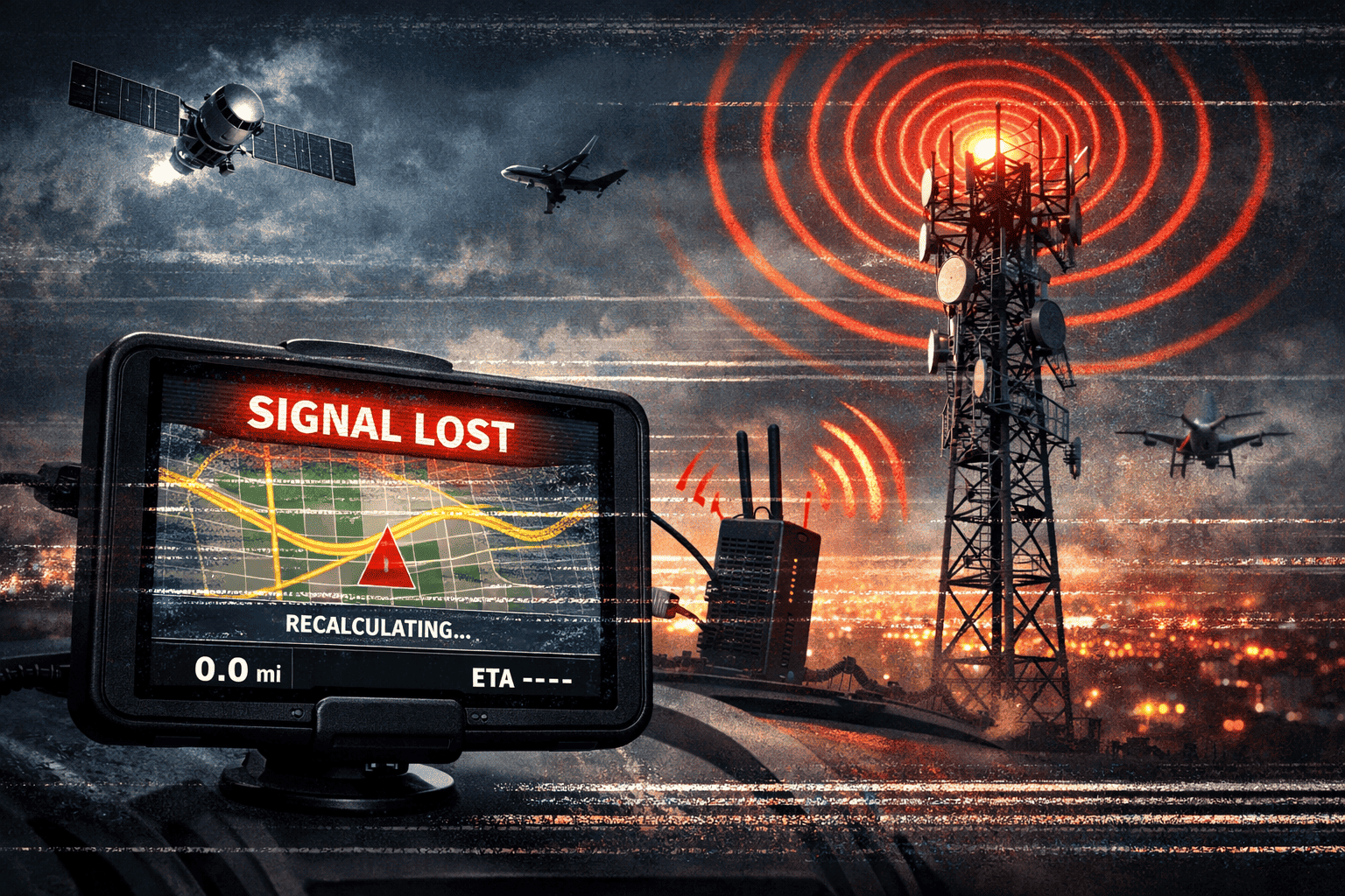
- GPS shows "no position" or "signal lost"
- FMS (Flight Management System) loses GPS navigation
- Reverts to IRS/INS (inertial navigation) if available
- ADS-B Out may be affected (position reporting)
- Autopilot may disconnect or switch modes
Visual indication: GPS receivers typically show:
- "GPS LOST"
- "NO GPS"
- "NAV ACCUR DOWNGRADED"
- Red X through GPS indication
GPS Spoofing: False Information Attack
What it is: Broadcasting fake GPS signals that appear legitimate, causing receivers to calculate incorrect positions.
How it works: A spoofer transmits signals mimicking genuine GPS satellites but with false timing or position data. These signals are often stronger than real satellites, causing receivers to lock onto fake signals instead.
Effect on aircraft:
- GPS shows wrong position (sometimes hundreds of miles off)
- Incorrect altitude displayed (may show negative altitudes)
- Wrong time displayed (can affect systems synchronized to GPS time)
- FMS routes to wrong location
- Autopilot may attempt to fly to spoofed position
- No obvious warning—system thinks GPS is working correctly
More dangerous than jamming: Spoofing is harder to detect because the GPS system doesn't know it's receiving false data. Pilots may not realize GPS is unreliable until they notice position doesn't match other navigation sources.
How NOTAMs Warn About GPS Interference
Standard GPS NOTAM Format
GPS interference NOTAMs follow specific formats. Here's a real example:
Q) LTAA/QPIAU/IV/NBO/A/000/999/4055N02845E250
A) LTAA
B) 2403040600 C) 2403042100
E) GPS INTERFERENCE EXPECTED. GPS MAY BE UNRELIABLE WITHIN
250NM RADIUS OF 404530N 0284500E. GNSS BASED OPS INCLUDING
RNAV, RNP, AND ADS-B MAY BE AFFECTED. PILOTS REPORT
MULTIPLE INSTANCES OF GPS SIGNAL LOSS AND POSITION ERRORS.
ALTERNATIVE NAVIGATION METHODS REQUIRED.
Key elements:
- Q-line QPIAU: Indicates GPS/GNSS interference
- Geographic area: Center point and radius (250NM in example)
- Altitude range: 000/999 = surface to unlimited
- Time window: When interference is expected
- Specific warning: Types of operations affected
NOTAM Language to Recognize
GPS interference NOTAMs use specific terminology:
Direct warnings:
- "GPS UNRELIABLE"
- "GNSS INTERFERENCE EXPECTED"
- "GPS SIGNAL MAY BE DEGRADED"
- "GPS JAMMING ACTIVE"
- "GNSS BASED NAVIGATION NOT AVAILABLE"
Testing notices:
- "GPS TESTING IN PROGRESS"
- "JAMMER TESTING"
- "EW (Electronic Warfare) EXERCISES"
- "MILITARY EXERCISES MAY AFFECT GPS"
Affected systems:
- "RNAV APPROACHES NOT AVAILABLE"
- "RNP OPERATIONS NOT AUTHORIZED"
- "ADS-B MAY BE AFFECTED"
- "LPV MINIMA NOT AVAILABLE"
- "GBAS/SBAS UNRELIABLE"
Geographic Hotspots: Where GPS Interference Occurs
High-Risk Regions (2024-2026 Data)
1. Eastern Mediterranean & Middle East
Countries affected: Turkey, Cyprus, Israel, Lebanon, Syria, Iraq, Iran
Frequency: Daily reports, thousands of incidents monthly
Type: Both jamming and spoofing
Severity: Extreme. Multiple aircraft simultaneously affected. Spoofing incidents showing positions over neighboring countries, negative altitudes, or impossible locations.
Routes impacted:
- All flights through Turkish airspace
- Approaches to Tel Aviv (LLBG), Beirut (OLBA)
- Overflights of Syria and Iraq
- Eastern Mediterranean coastal routes
2. Baltic Region
Countries affected: Finland, Estonia, Latvia, Lithuania, Poland
Frequency: Daily, particularly near Kaliningrad and Russian border
Type: Primarily jamming
Severity: High. Affects commercial traffic, particularly approaches to Helsinki (EFHK), Tallinn (EETN), Riga (EVRA)
3. Black Sea Region
Countries affected: Ukraine, Romania, Georgia, Russia
Frequency: Constant in conflict areas
Type: Extensive jamming and spoofing
Severity: Critical. Most commercial flights avoid the region entirely.
4. Persian Gulf
Countries affected: UAE, Saudi Arabia, Oman, Qatar, Iran
Frequency: Intermittent, increasing during regional tensions
Type: Both jamming and spoofing
Severity: Moderate to high. Affects approaches to major hubs (Dubai, Doha, Riyadh)
5. Western US Military Ranges
Locations: Nevada, California, New Mexico, Arizona
Frequency: Scheduled testing, well-documented in NOTAMs
Type: Controlled jamming tests
Severity: Low to moderate. Predictable and NOTAMed in advance.
Real-World Examples: When GPS Goes Wrong
Example 1: Mediterranean Spoofing Incident (2023)
Location: Eastern Mediterranean, overflying Cyprus
What happened: Multiple aircraft reported GPS showing positions over Lebanon (120+ miles from actual position), altitudes showing -2,000 to -4,000 feet while at FL350-390, and clock times offset by hours.
Aircraft affected: Over 50 commercial flights in one day
Pilot actions:
- Cross-checked position with VOR/DME
- Used inertial navigation
- Coordinated with ATC (radar position)
- Manually navigated using conventional navaids
Outcome: No incidents, but significant workload increase. Some airlines rerouted to avoid area.
Example 2: Baltic Jamming Pattern (2024)
Location: Gulf of Finland, approaches to Helsinki
What happened: GPS signal loss affecting aircraft on approach, requiring reversion to ILS or visual approaches.
Impact:
- RNP approaches not available
- Delays during poor weather (ILS only)
- ADS-B coverage gaps
- Increased ATC workload (procedural separation)
Response: Permanent NOTAM issued. Airlines brief crews. Conventional approaches planned in advance.
Example 3: Newark GPS Testing (Annual)
Location: New York area, including Newark (KEWR), JFK (KJFK), LaGuardia (KLGA)
What happens: FAA conducts GPS jamming tests for research. Well-publicized, NOTAMed weeks in advance.
Impact:
- GPS approaches not available during test windows
- Airlines plan conventional approaches
- Minimal operational impact (expected and prepared)
Key difference: Predictable, controlled, coordinated with users. Shows how GPS testing should be done.
How Pilots Should Respond to GPS Interference
Recognition: Detecting GPS Problems
Jamming is obvious:
- GPS system shows "NO GPS" or similar
- FMS indicates navigation accuracy downgrade
- Autopilot may disconnect or change modes
- Clear indication of problem
Spoofing is subtle:
- GPS position doesn't match radar position (ask ATC)
- Position doesn't match VOR/DME cross-check
- Groundspeed unrealistic (GPS shows 700kt in a 737)
- Altitude unrealistic (negative altitude at cruise)
- Time display incorrect (hours off)
- Position "jumps" suddenly to new location
Immediate Actions: The 5-Step Response
Step 1: Recognize and Announce
- Identify GPS is unreliable
- Alert other crew members
- Don't trust GPS-derived information
Step 2: Revert to Alternative Navigation
- Use IRS/INS if available
- Tune VOR/DME stations
- Use ATC radar vectors
- Dead reckoning if necessary
Step 3: Verify Position
- Request radar position from ATC
- Cross-check with VOR/DME
- Use visual reference if VMC
- Compare with inertial navigation
Step 4: Inform ATC
- Report "GPS unreliable" or "GPS lost"
- Request radar vectors if needed
- Advise if unable RNAV/RNP procedures
- Ask for conventional approach if available
Step 5: Report the Incident
- File GPS interference report with authorities
- Note time, position, type of interference
- Include in post-flight report
- Helps authorities track patterns
Flight Planning in GPS-Denied Areas
Pre-flight preparation:
- Check NOTAMs carefully - Look for GPS warnings in departure, en-route, and arrival areas
- Plan conventional backup - Identify VOR/DME routes, conventional approaches available
- Verify IRS operation - Ensure inertial navigation is working and properly aligned
- Load alternative approaches - Have ILS/VOR approaches loaded in addition to RNAV
- Carry charts - Have conventional navigation charts, not just GPS-dependent plates
- Increase fuel - Plan for potential delays, holds, or diversions
In-flight contingency:
- Monitor GPS continuously in known interference areas
- Cross-check position regularly (every 5-10 minutes)
- Be ready to switch navigation sources immediately
- Maintain situational awareness of conventional navaids
The Technology Behind the Problem
Why GPS Is Vulnerable
Signal weakness: GPS satellites transmit with only 25-50 watts from 12,000+ miles away. By the time signals reach Earth, they're incredibly weak—below background noise levels.
No authentication: Civilian GPS (and most aviation GPS) has no signal authentication. Receivers trust that incoming signals are legitimate.
Predictable structure: GPS signal structure is publicly documented, making spoofing technically feasible.
Easy to jam: Handheld GPS jammers (illegal but available) can affect receivers within several miles.
Military vs. Civilian GPS
Military GPS (P(Y) code):
- Encrypted signals
- Authentication prevents spoofing
- More resistant to jamming
- Not available to civilian aviation
Civilian GPS (C/A code):
- Unencrypted, public signals
- No authentication
- Vulnerable to both jamming and spoofing
- Used by all commercial aviation
Emerging Solutions
Multi-constellation GNSS: Using GPS + GLONASS + Galileo + BeiDou simultaneously makes interference harder (attacker must jam/spoof all systems).
Receiver Autonomous Integrity Monitoring (RAIM): Built-in algorithms that detect inconsistencies in GPS signals. Can identify some spoofing attempts.
Inertial integration: Combining GPS with inertial navigation systems (IRS/INS) provides backup and can detect sudden GPS position jumps.
Alternative PNT (Position, Navigation, Timing):
- eLoran - Enhanced long-range navigation system
- DME/DME - Using existing DME infrastructure for position
- Vision-based navigation - Using cameras and AI
- Still in development or limited deployment
Regulatory and Industry Response
ICAO Standards
ICAO requires:
- GPS interference to be NOTAMed when known
- Alternative navigation capability for RNAV/RNP operations
- Reporting of interference incidents
- Crew training on GPS failure procedures
FAA Position
The FAA has:
- Issued guidance on GPS interference reporting
- Established GPS interference detection networks
- Required alternative navigation capability
- Conducted research on jamming/spoofing detection
- Worked with military to minimize interference during testing
EASA Approach
European Union Aviation Safety Agency:
- Requires crews to be trained on GPS interference
- Mandates interference reporting
- Working on alternative PNT solutions
- Coordinates with military authorities on jamming
Airline Procedures
Many airlines have developed specific procedures:
- GPS interference checklists
- Route planning to avoid known interference areas
- Mandatory IRS for flights through high-risk regions
- Additional fuel requirements for GPS-denied operations
- Crew briefings on regional interference patterns
The Future: GPS Interference Trends
Increasing Frequency
GPS interference incidents have increased dramatically:
- 2020: ~10,000 reported incidents globally
- 2022: ~30,000 reported incidents
- 2024: Over 50,000 reported incidents
Factors driving increase:
- Geopolitical tensions and conflicts
- Easier access to jamming/spoofing technology
- Military electronic warfare exercises
- Better reporting and detection
Expanding Geographic Scope
Interference is no longer limited to conflict zones:
- Testing and exercises in Western countries
- Protection of sensitive facilities (power plants, government buildings)
- Criminal use (truck cargo theft, etc. affecting nearby aviation)
- Accidental interference from poorly designed equipment
Technological Evolution
Spoofing is becoming more sophisticated:
- Gradual position shifts (harder to detect)
- Multi-frequency spoofing (affects multiple GNSS systems)
- Dynamic spoofing (adjusts to aircraft movement)
Detection is improving:
- Advanced RAIM algorithms
- Multi-sensor integration (GPS + INS + vision)
- Ground-based monitoring networks
- Crowdsourced interference reporting
Practical Checklist: GPS Interference Operations
Pre-Flight (Planning Phase)
✅ Review NOTAMs for GPS warnings along entire route
✅ Check interference databases for known hotspots
✅ Identify conventional navaids along route
✅ Plan conventional approaches at destination and alternates
✅ Verify IRS alignment and operation
✅ Load backup routes using VOR/DME
✅ Add contingency fuel for potential delays
✅ Brief crew on GPS interference procedures
In-Flight (Monitoring Phase)
✅ Monitor GPS status continuously in known interference areas
✅ Cross-check position every 5-10 minutes using VOR/DME or ATC
✅ Verify groundspeed makes sense (compare with winds)
✅ Check altitude indication for anomalies
✅ Watch for sudden position jumps
✅ Compare multiple navigation sources (GPS vs IRS vs VOR)
During Interference (Response Phase)
✅ Immediately stop trusting GPS
✅ Switch to alternative navigation (IRS, VOR/DME, ATC vectors)
✅ Verify position with ATC
✅ Inform ATC of GPS issues
✅ Select conventional approach if on arrival
✅ Increase monitoring of all navigation sources
✅ Consider diversion if unable to navigate safely
Post-Flight (Reporting Phase)
✅ File interference report with aviation authority
✅ Document time, location, type of interference
✅ Include in company report
✅ Debrief crew on lessons learned
✅ Review procedures for improvement
Conclusion: Navigating an Uncertain Future
GPS interference has evolved from a theoretical threat to an operational reality that every pilot and airline must prepare for. NOTAMs provide critical warnings, but they're only the first line of defense.
The skills that defined aviation for decades—VOR navigation, dead reckoning, celestial navigation—are suddenly relevant again. Modern pilots must be proficient in both glass-cockpit automation and traditional navigation techniques.
Key takeaways:
- GPS interference is increasing in frequency and geographic scope
- NOTAMs warn of known interference, but unexpected incidents occur
- Spoofing is more dangerous than jamming because it's harder to detect
- Always have alternative navigation capability and know how to use it
- Cross-check GPS against other sources regularly
- Report all interference incidents to help the aviation community
As technology advances, so do the threats. But with proper preparation, awareness of NOTAMs, and proficiency in alternative navigation, pilots can safely navigate even when GPS fails.
The sky may be full of invisible radio signals, but the fundamental principles of navigation remain: know where you are, know where you're going, and always have a backup plan.
Stay Informed: Check GPS Interference NOTAMs
Before every flight, check for GPS interference warnings using NOTAM Viewer. Search by airport, FIR, or region to see active GPS-related NOTAMs worldwide.