The Drone Revolution Meets Aviation
December 19, 2018. London Gatwick Airport—the UK's second busiest—came to a complete standstill. Not because of weather. Not due to mechanical issues. But because of drones.
For 36 hours, reported drone sightings near the runway forced the closure of one of Europe's major hubs. Over 1,000 flights were cancelled or diverted. 140,000 passengers were stranded. The economic cost exceeded £50 million. And the aviation industry woke up to a stark reality: drones had become a critical safety threat.
This wasn't an isolated incident. In the years since, drone encounters near airports have skyrocketed. In 2023 alone, the FAA reported over 2,400 drone sightings by pilots in the United States—an average of nearly 7 per day. Worldwide, the numbers are even higher.
📊 Growing Problem: Drone sightings near airports increased 300% between 2020 and 2024. NOTAMs for drone activity have become daily occurrences at major airports worldwide.
Understanding Drones in Aviation Context
What Aviation Calls "Drones"
The aviation industry uses several terms:
- UAS - Unmanned Aircraft System (official FAA term)
- UAV - Unmanned Aerial Vehicle
- Drone - Common term (includes recreational and commercial)
- sUAS - Small Unmanned Aircraft System (under 55 lbs)
- RPA - Remotely Piloted Aircraft (ICAO term)
For NOTAM purposes, all refer to unmanned aircraft operating in the same airspace as traditional aviation.
Why Drones Are Dangerous to Aircraft
Collision risk: Even small drones can cause catastrophic damage. A 2-pound drone hitting an aircraft at 250 knots has the kinetic energy of a bowling ball thrown at highway speeds. Critical areas at risk:
- Windscreen - Could shatter, incapacitating pilots
- Engine ingestion - Could cause engine failure
- Leading edges - Wing or stabilizer damage affecting control
- Radome - Damage to weather radar
Pilot distraction: Even if no collision occurs, drone sightings distract pilots during critical phases of flight (takeoff, approach, landing).
Airport disruption: Drone sightings can force runway closures, departures halts, and arrival diversions—as Gatwick proved.
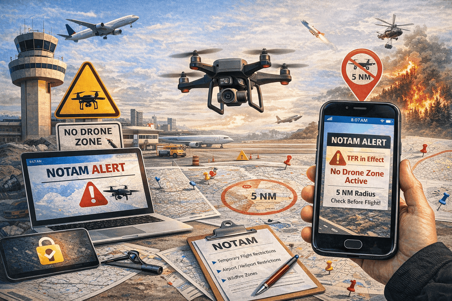
How NOTAMs Address Drone Activity
Standard Drone NOTAM Format
Drone NOTAMs follow specific formats. Here's a real example:
394612N1045115W (DENVER INTL) SFC-400FT AGL
2403051400-2403051800
Q) ZDV/QWULW/IV/BO/W/000/004/3946N10451W005
A) KDEN B) 2403051400 C) 2403051800
E) UNMANNED AIRCRAFT ACTIVITY WI AN AREA DEFINED AS 5NM RADIUS
OF 394612N1045115W (DENVER INTL ARPT). ALTITUDE 400FT AGL.
CONTACT 303-555-1234. FOR CD/DAL PHONE 303-555-5678.
Key elements:
- QWULW: Q-code for UAS activity
- Geographic area: Radius from a point (5NM in example)
- Altitude: Surface to specific height (400 FT AGL common)
- Time window: When drone operations are active
- Contact info: Operator phone number for coordination
Types of Drone NOTAMs
1. Authorized Drone Operations
These NOTAMs announce legitimate, approved drone flights:
- Commercial photography/videography
- Infrastructure inspection (bridges, power lines, pipelines)
- Survey operations
- Agricultural operations
- Search and rescue
- News media coverage
These include contact information and are coordinated with ATC.
2. Drone Sighting Reports
When pilots or tower personnel spot unauthorized drones:
2NM FINAL RWY 31L AT 1345Z. ALTITUDE APPROX 1500FT.
PILOTS REPORT SIGHTINGS. USE CAUTION.
These are urgent warnings based on visual reports.
3. Temporary Flight Restrictions (TFRs) for Drones
Special events may have drone TFRs prohibiting ALL drone operations:
- Major sporting events (Super Bowl, World Series)
- Presidential movements
- Disaster areas (preventing interference with relief flights)
- Wildfire areas (protecting firefighting aircraft)
- Emergency response zones
4. Permanent Drone Restrictions
Some areas have permanent drone prohibitions:
- Within 5 miles of airports (without authorization)
- Restricted airspace (military bases, power plants)
- National security areas
- Government facilities
Major Drone Incidents and Their NOTAMs
Case Study 1: Gatwick Airport (December 2018)
The incident: Multiple drone sightings over 36 hours forced the complete closure of London Gatwick.
Timeline:
- Dec 19, 21:03: First drone sighting reported
- 21:15: Airport closed, all flights suspended
- 03:01: Airport briefly reopens
- 03:45: More drone sightings, airport closes again
- Next 36 hours: Sporadic sightings, airport remained closed
- Dec 21, 14:00: Airport finally reopens with restrictions
Impact:
- 1,000+ flights cancelled
- 140,000 passengers affected
- £50+ million in economic damage
- Military deployed with drone detection equipment
- Suspects arrested (later released without charge)
NOTAMs issued: Multiple emergency NOTAMs closing the airport, restricting airspace, and coordinating with military drone counter-measures.
Aftermath: UK strengthened drone laws, airports invested in detection systems, international aviation community reassessed drone threat response.
Case Study 2: Dubai International (Multiple Incidents)
The pattern: Dubai International, one of the world's busiest airports, experienced repeated drone incursions throughout 2023-2024.
Notable incidents:
- February 2023: 30-minute closure, 15 flights delayed
- May 2023: 45-minute closure during peak arrivals
- September 2023: Extended closure affecting 50+ flights
- January 2024: Multiple sightings over 2 hours
Response: UAE implemented strict drone regulations, deployed advanced detection systems, and increased penalties for violations (up to $272,000 fines).
Case Study 3: Newark Liberty (July 2023)
The incident: Drone sighting near Newark runway forced ground stop during evening arrivals rush.
Impact:
- 43-minute ground stop
- Arrivals held or diverted
- Departures delayed
- Ripple effects across Northeast US
NOTAM issued: Immediate airspace restriction and coordination with FAA, NYPD, and FBI.
Reading Drone-Related NOTAMs
Key NOTAM Codes for Drones
Q-Code identifiers:
- QWULW: UAS (drone) activity
- QWURW: UAS restriction in place
- QWXXX: UAS-related airspace changes
Subject code: UAS - Appears in many drone NOTAMs
Understanding Geographic Restrictions
Drone NOTAMs typically define areas as:
- Radius from point: "5NM radius of KJFK"
- Corridor: "Along Route I-95 between..."
- Polygon: Defined by multiple coordinates
- Airport vicinity: Standard 5NM around airport reference point
Altitude Considerations
Most recreational drones are limited to 400 ft AGL, but NOTAMs may specify:
- SFC-400FT AGL: Standard recreational limit
- SFC-1000FT AGL: Commercial operations with waiver
- SFC-FL180: Advanced operations (rare)
- Specific altitudes: "Operations at 800FT MSL"
What Pilots Should Do
Before Flight: NOTAM Check
Always check for:
- Active drone TFRs along route
- Authorized drone operations near departure/arrival
- Recent drone sightings at destination
- Permanent drone restriction areas
Search NOTAM keywords:
- "UAS"
- "DRONE"
- "UNMANNED"
- "RPA"
During Flight: Drone Encounter
If you see a drone:
- Maintain aircraft control - Don't make sudden maneuvers
- Note details:
- Time (UTC)
- Location (lat/long or VOR radial/distance)
- Altitude
- Description (size, color, type)
- Direction of flight
- Report to ATC immediately
- Complete flight safely - Don't chase or investigate drone
- File report post-flight with FAA (US) or relevant authority
Standard phraseology:
approximately 500 feet, moving northwest."
Reporting Drone Sightings
In the United States:
- Report to ATC in real-time
- File FAA Form at hotline.faa.gov
- Optional: Report to local law enforcement
Internationally: Report to ATC and national aviation authority per local procedures.
Technology: Drone Detection Systems
How Airports Detect Drones
Major airports now deploy multi-layered detection:
1. Radar Systems
- Specialized radar for small, slow targets
- Can detect drones several miles away
- Challenges: Small radar cross-section, ground clutter
2. Radio Frequency (RF) Detection
- Detects drone control signals
- Can identify drone type and operator location
- Range typically 3-5 miles
3. Optical/Camera Systems
- High-resolution cameras scan approach paths
- AI-powered recognition algorithms
- Thermal imaging for night detection
4. Acoustic Sensors
- Detect drone motor/propeller sounds
- Effective within 1-2 miles
- Can differentiate from other aircraft
Counter-Drone Measures
When unauthorized drones are detected:
- Protocol measures: Issue NOTAM, coordinate with authorities, alert pilots
- Active countermeasures (where legal):
- RF jamming (disrupts control signals)
- GPS spoofing (forces drone to land or return)
- Net capture systems (physical interception)
- Trained birds of prey (some airports)
Legal constraints: Many countermeasures restricted to law enforcement or military due to potential interference with other systems.
Regulatory Framework
United States (FAA Rules)
Part 107: Commercial drone operations
- 400 ft AGL altitude limit
- Visual line of sight required
- Daylight operations only (waiver available)
- No operations over people (waiver available)
- Must yield right-of-way to manned aircraft
Recreational Exception:
- Follow CBO (Community Based Organization) guidelines
- Register drone if over 0.55 lbs
- No operations in controlled airspace without authorization
- 5-mile airport buffer requires notification/authorization
Penalties for violations:
- Civil penalties up to $32,666 per violation
- Criminal penalties up to $250,000 and 3 years imprisonment
- Drone confiscation
European Union (EASA Rules)
Drone categories:
- Open: Low-risk operations (under 25kg, visual line of sight)
- Specific: Medium-risk operations (requires authorization)
- Certified: High-risk operations (similar to manned aircraft)
Geo-awareness requirement: Drones must have built-in awareness of restricted zones.
United Kingdom (CAA Rules)
Post-Gatwick, UK strengthened regulations:
- Extended airport exclusion zones to 5km (3.1 miles)
- Mandatory registration for all drones over 250g
- Operator competency test required
- Maximum penalties: Unlimited fine and/or 5 years imprisonment for endangering aircraft
The Future: Drone Integration
UTM (UAS Traffic Management)
NASA and FAA are developing UTM systems to manage drone traffic:
- Real-time tracking of all airborne drones
- Automated geo-fencing and collision avoidance
- Integration with traditional ATC systems
- Dynamic airspace allocation
Timeline: Phased implementation through 2030s
Remote ID Requirement
US implementation (September 2023):
- All drones must broadcast identification and location
- Enables tracking of unauthorized drones
- Helps law enforcement identify operators
- Similar to aircraft transponders
Global adoption: EU and other regions implementing similar requirements
Beyond Visual Line of Sight (BVLOS)
Future commercial operations will include:
- Drone package delivery (Amazon, UPS, etc.)
- Long-range inspections
- Agricultural monitoring
- Emergency medical supply delivery
NOTAM implications: Expect more complex, corridor-based NOTAMs as BVLOS operations increase.
Practical Pilot Checklist
Pre-Flight
✅ Check NOTAMs for drone TFRs along route
✅ Review authorized drone operations near departure/destination
✅ Note any recent drone sightings
✅ Brief crew on drone encounter procedures
✅ Ensure familiarity with reporting requirements
In-Flight
✅ Maintain extra vigilance during approach and departure
✅ Monitor ATC frequencies for drone reports
✅ Scan for drones during visual approaches
✅ Be prepared to report sightings immediately
If Drone Encountered
✅ Maintain aircraft control (don't make sudden maneuvers)
✅ Note time, location, altitude, description
✅ Report to ATC immediately
✅ File formal report post-flight
✅ Document in logbook if significant
Conclusion: Adapting to the Drone Age
Drones are here to stay. From hobbyist quadcopters to commercial delivery systems, unmanned aircraft are becoming a permanent feature of our airspace. The challenge for aviation is integration without compromising safety.
NOTAMs are the primary tool for managing this integration, warning pilots of drone activity and restricted areas. As detection technology improves and regulations evolve, the NOTAM system will continue adapting to this new reality.
For pilots, the message is clear: drone awareness is no longer optional. Check your NOTAMs. Know the regulations. Report sightings. And always maintain vigilance during critical phases of flight.
The Gatwick incident proved that a small drone can ground an entire airport. The next incident could be prevented by a pilot who checked their NOTAMs and knew what to do.
Check Drone NOTAMs Before Every Flight
Search for UAS and drone-related NOTAMs at your departure, destination, and along your route. NOTAM Viewer makes it easy to find drone restrictions worldwide.